My wife's great Aunt's family lived in a small house on the sand dunes at Eskmeals in Cumberland. As with Tyneham in Dorset, or Imber on Salisbury plain, the MoD came along at the beginning of the 20th Century and requisitioned the land. At Eskmeals, they were moved a short way away, and the 1920s replacement is still in the family, used over generations as a holiday home. The nature reserve is often closed to visit during the working week.
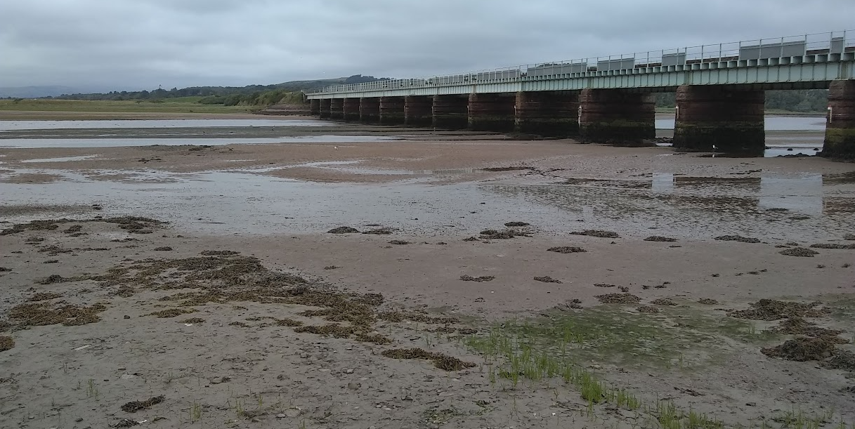
Walking down to the nearby estuary, wading in the shallows, and watching people getting stuck whilst squeezing cars under the railway viaduct at high tide has long been a family pastime. Indeed, as we arrived for our week here, there was an Audi with bonnet up, still sat there three hours later, awaiting repair.
So with the privilege of staying in the closest house, and a week to consider, I wondered just how untenable the crossing is. Surely it is a ford because historically people crossed here on foot as well as on horseback ? A photo online shows a horserider splashing through quite shallow water. But I can find nothing online highlighting how deep the ford actually is.
I was impressed by Ruth's walking blog, which describes getting between here and Ravensglass, a short hop across the River Esk. https://coastalwalker.co.uk/2016/12/08/eskmeals-range-to-ravenglass/ She however described, in November, the uncertainties facing anyone who thinks of crossing here, and indeed, also at another ford at Hall Waberthwaite further up river. She ended up walking 3 miles up river to cross via the busy Muncaster bridge on the A591, and of course 3 miles back down the other side.
I should make a clear warning here. This is a tidal river, but also, being the Lakelands, the flows will be affected greatly by rainfall. Do your own research, be cautious, and be prepared to turn back.
However, a quick look at the tide tables https://www.tideschart.com/United-Kingdom/England/Cumbria/Ravenglass-Beach/ told me two things. Low water was at 9am the day after I arrived, and that as this was near spring tides, with higher low waters as my week progressed. The Low water mark was 1.7 metres above chart datum. High water at 2:44pm was 5.3 metres higher. My best chance for exploration was immediately.

As a student of sailing (you never graduate), I was able to check the charts. The datum levels show the whole river drying, which is unlikely given the river flow. but perhaps possible at an Equiox. The 5M drying contour and the spot reading of 2.7M drying highlights that it should be achievable.(this is Navionics, but the Admiralty chart shows the same soundings).

From the kitchen window, you can almost see the crossing point, and at 8am, there was a quad bike stopped for quite a while. I had thought to take an early look anyhow, but perhaps I could grab local knowledge too. Sadly as I walked down, he was on his mobile phone, the scourge of enabling live conversations, so we nodded hello, and I walked on.
There is no usable depth gauge on the viaduct, but out on the nature reserve to the left, aside from the stone pillars of the viaduct, there is a fence row of concrete posts out into the water. One hour before low water, it looked like this;

There are holes in the posts, I thought these might be a useful guide, but actually I couldn't see them later when I crossed. So half an hour later, I was back. Did I mention the warning?


A scruffy barking dog greeted me as I climbed towards the bank. Once I had risen off the mudflats, it wandered away, returning to more quietly observe the invader again as I neared the houses. From here I took the path south to Newbiggen, which was mostly an attractive lane between two hedges. Here was the third and smallest ford, you could almost jump across it, but it seemed churlish to ignore the footbridge provided.

But in turning right to take the photo above, I missed the footpath onwards to Eskmeals house, and returned instead via the road.

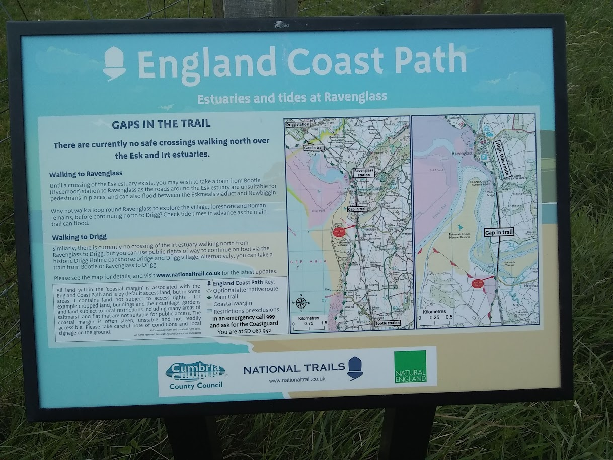
From the display board at the ford, Natural England ran an EU Funded project back in 2016, part of the English Coast Path study, which determined that the ford is unviable, and therefore a walking bridge link across the gap is needed. It would have been good if rather than spending loads of money restating the obvious, they had perhaps just worked to made the link actually happen ! https://assets.publishing.service.gov.uk/government/uploads/system/uploads/attachment_data/file/360629/whitehaven-silecroft-chpt-3.PDF
"Engineers will also take the opportunity to upgrade walkways and handrails across the viaduct which are used by railway staff." https://www.newcivilengineer.com/latest/152-year-old-cumbria-viaduct-set-for-vital-repairs-08-06-2020/ It did also look like they had only painted half of the bridge.